By Uttam Kumar Sinha
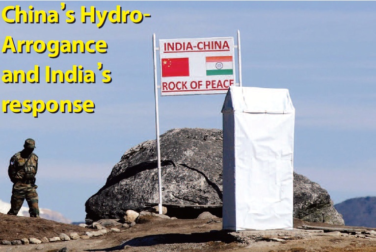
The Doklam standoff is a grim reminder that China will continue to dispute territories with India. The Chinese imperious push to its south recalls how Mao Zedong, the founder of the People’s Republic of China in 1949, described Tibet as the palm of the hand and the five fingers as Ladakh, Nepal, Bhutan, Sikkim and Arunachal (formerly NEFA). By claiming territories, China also usurps vast amount of natural resources including water. For example, the occupation of Aksai Chin has given China the control of a large section of the meandering Indus river. Likewise, its claim of Arunachal Pradesh as ‘South Tibet’ is made with an eye over the voluminous Brahmaputra. And not surprisingly, China’s claim to Doklam means the Teesta river, gushing down from the spiralling heights of the Pahunri glacier, will fall in its territory.
India and China share boundaries and also rivers. Among these rivers the Brahmaputra, known as the Yarlung Tsangpo in Tibet, has become a source of anxiety for India. As a lower riparian, India’s concerns revolve around the current as well as future dam projects and the frightening prospect of water diversion of the Yarlung. Both these upstream activities will lead to flow fluctuations and impact the local economy and ecology downstream.
China’s cascade of dams on the main stem of the Yarlung is part of its New Energy Development as outlined in the last three five year plans. The first of such hydroelectricity projects, the 510-MW Zangmu, was operationalised in 2015. The Lalho hydroelectric project at Xigaze (Shigatse), not too far from the junction of Bhutan and Sikkim, is expected to be completed by 2019. Three more dams on the middle reaches of the Yarlung have been approved, these are Dagu (640-MW), Jiexu and Jiacha (340 MW). China also plans to build 37 dam projects on the various tributaries that join the Yarlung.
There exists no bilateral or multilateral water management accord in the Brahmaputra basin. This is primarily because China does not believe in water sharing agreements. In contrast, India follows the principles of equitable distribution and no significant harm with its neighbours on rivers, as the 1960 Indus Waters Treaty with Pakistan and the 1996 Ganga Treaty with Bangladesh clearly demonstrates.
MoUs on Rivers
In 2002, India and China signed a MoU on the sharing of hydrological information on the Yarlung/Brahmaputra in flood season. Under this arrangement, the two sides regularly exchanged data, from 1 June to 15 October, on water levels, discharge, and rainfall, at the Nugesha, Yangcun, and Nunxia stations, which were utilised in the formulation of flood forecasts by India’s Central Water Commission. This ended in 2007 and a second MoU, with the same provisions and with a validity of 5 years, was signed in 2008 and was again renewed for five years in 2013. With regards to the Sutlej (Langquin Zangbu), an MoU in 2005 was signed on sharing hydrological information in flood season for a period of five years; this was renewed in 2010 and then again in 2015.
In November 2006, when President Hu Jintao visited India, the two countries agreed on the constitution of an Expert-Level Mechanism (ELM) to discuss wider cooperation, including emergency management. The ELM meets once a year alternately in Beijing and New Delhi and essentially focuses on the exchange of hydrological information and the smooth transmission of flood season hydrological data. It is very selective and limited but forms the base on which future water dialogue can be further developed.
During the visit of Chinese Premier Li Keqiang in May 2013, serious time and discussion was given to water issues. India’s proposal of a joint mechanism for better transparency on the dams being constructed on the Yarlung was appreciated but failed to elicit a clear commitment from China. The Chinese followed the tested 2002 MoU format and renewed the pact on twice-daily sharing of hydrological data of the Brahmaputra River during the monsoon. A forward step was taken by signing a new MoU for cooperation in “ensuring water-efficient irrigation”.
In October 2013, when the then Indian Prime Minister Manmohan Singh visited Beijing, the two countries reached further understanding to strengthen water cooperation on provisions of flood-season hydrological data and emergency management. It was also agreed that flow information provided by China would now commence from May 15 instead of June 1, starting 2014.
Power asymmetry is important for China in the Brahmaputra basin and, therefore, rejects any permanent mechanism on water issues. By reviewing and renewing the MoU, China dictates the proceedings as an upper riparian. It is effectively mixing ‘cohesion and compliance’ with ‘attraction and intimidation’, what the Marxist political philosopher Antonio Gramsci famously termed “a mix of force and consent.”
India’s response
India receives many rivers including the Indus, Sutlej and Brahmaputra which originate in the Tibetan plateau. Of the nine major tributaries of the Ganga that flow in from Nepal, the three principal tributaries Karnali, Gandaki and Kosi also rise from Tibet. From a hydrological perspective, India is middle riparian receiving rivers before the water flows to other neighbouring countries like Pakistan and Bangladesh. India’s riparian position increases its vulnerability to China particularly in flood season. There are also huge concerns of natural disasters like glacial lake outburst flood that happened on the Pareechu river in 2005 leading to enormous damage downstream in Himachal Pradesh.
Given India’s hydrological position as down riparian with China and upstream with Pakistan and Bangladesh, its hydro-diplomacy has to be well nuanced. For one, it is critical for India to articulate its middle riparian position to change the perception in the neighbourhood that China and not India is a ‘water hegemon’, as is often expressed by Pakistan and Bangladesh, in spite of the water treaties with these two countries. Second, in any further dialogue with China, rivers should be brought as a core issue of negotiations and not just a perfunctory matter. Of course, China is not going to comply but at least its insensitivity towards downstream concerns can be a message to the rest of the down riparian countries.
At best India can trust China in sharing the hydrological data but authenticity of the data received needs to be verified. The MoUs on the Brahmaputra and Sutlej are not permanent but renewed every 5-years with India paying for the exchange of the data in advance. The arrangement works well when the political climate is cordial and it’s hardly surprising that China has conveniently decided to ignore the data sharing in midst of the Doklam issue.
The geographical fact that China is the supreme upper riparian that dismisses international norms and principles of water sharing will remain. But India can enhance its own monitoring and verifying capabilities of the flows of the rivers that come from China and think in an integrated manner about storage facilities and flood mitigation programme.
China’s frequent claim to Arunachal should be also be countered by raising the water resources in Tibet as an ecological ‘commons’ and that China alone cannot be the stakeholder. Articulating globally an ecological perspective and principles of resource conservation is a useful counter narrative to China’s hydro-hegemony.
Tibet’s ecology has been a key issue for civil society and powerful environmental groups like the International Union for Conservation of Nature (IUCN) that are campaigning for Tibet as a vulnerable area to be protected from rampant resource exploitation. Also to remember is that China has ratified the 1972 UNESCO World Heritage Convention and in 2003 about 1.7 million hectares in Yunnan province, where many of the major river flows, was declared a World Heritage site. Likewise, Chinese environmentalists campaigned in 2008 to preserve the Tiger Leaping Gorge from the impact of a proposed dam. The government had to respond by moving the site of the dam away from the gorge. Continued resistance in China has forced the communist regime to abandon all the 13 dam projects on the Nu river (called Thanlwin in Maynmar and Salween in Thailand). This is quite a triumph for the Chinese environmental groups and scientists who have campaigned for more than a decade to keep the Nu river flowing.
However, China continues aggressively to pressure the current Myanmar government to build 5 mega dams that were approved by the previous regime and thereby export 90 per cent of the electricity generated from the dams in Myanmar. But does China require so much electricity? Reports suggest that the Yunan province is already energy surplus. Clearly, dam building projects in other countries like its massive infrastructural ventures across the globe are not just classical pursuit of economic interest but an expansion of Chinese imperial power.
It is unlikely that China will adjust its hydro-hegemonic position. But there are ways to pursue positive interactions on the Brahmaputra exclusive of China. An important element of hydro-diplomacy would be for India to initiate a lower riparian coalition stretching from the Ganga-Meghna-Brahmaputra to the Thanlwin/Salween and Mekong basins. One such calculation can be to consider strongly a multi-basin treaty on the Brahmaputra with Bhutan and Bangladesh. Competing powers instinctively think of counter-weights.
More than knee-jerk counter-responses, India needs to think of cohesive engagement. The Mekong Ganga Cooperation (MGC) and the government’s recent initiatives to expand the areas of cooperation among the member countries that includes Thailand, Myanmar, Cambodia, Laos and Vietnam are vital to the sustainability of India’s Act East Policy. Whether it is tourism, culture, transport and communication, rivers can be a force multiplier.
(The writer is a Fellow at the Institute for Defence Studies and Analyses, New Delhi)
Author
(The views expressed are the author's own and do not necessarily reflect the position of the organisation)